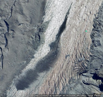
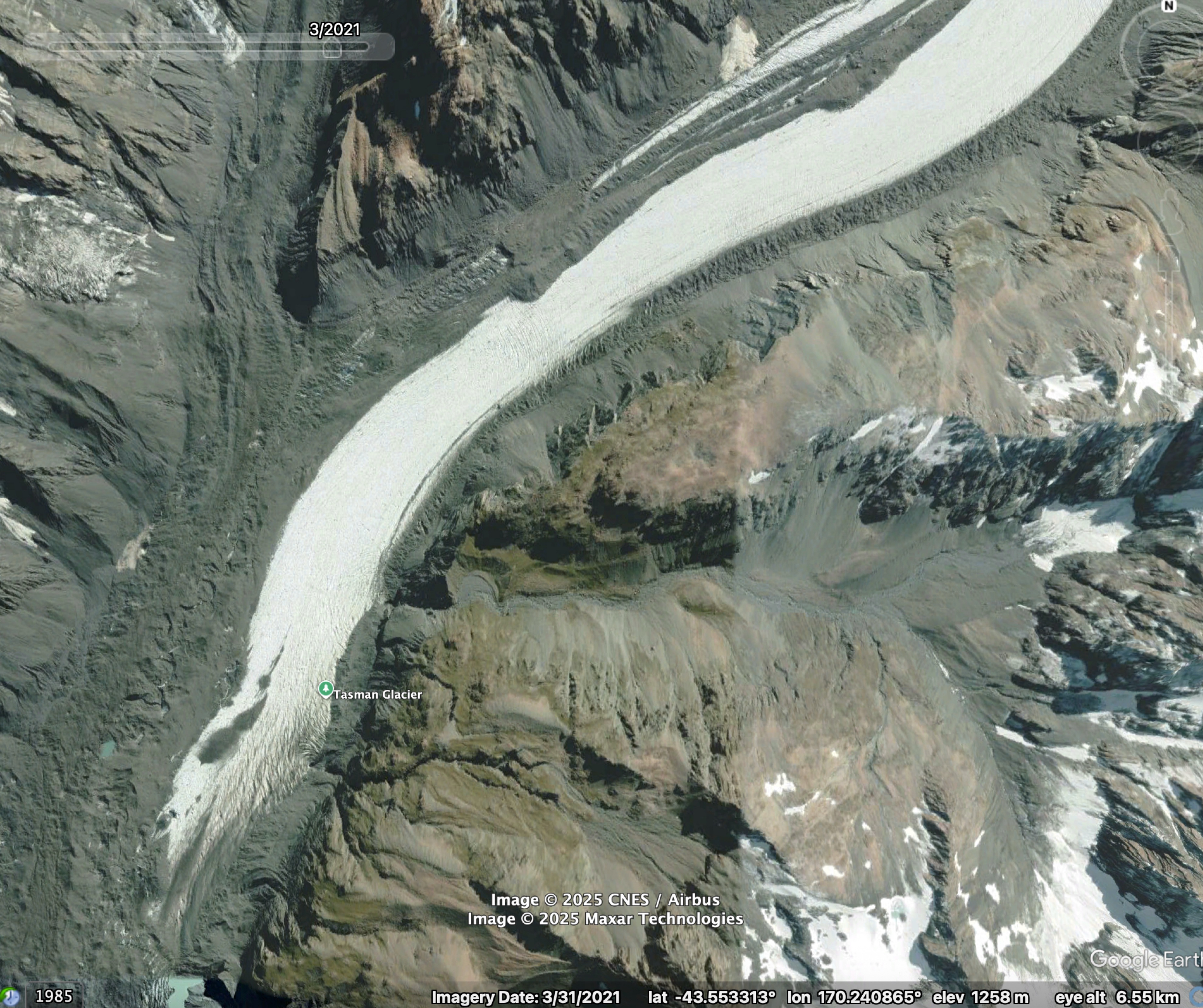
There’s a small smudge of supraglacial debris on Haupapa Tasman Glacier, positioned just above the upper limit of the continuous debris cover. At first glance, it looks like it might have fallen from a large landslide or perhaps broken off the lateral moraine. Curious, I traced it back in time using Google Earth’s (GE) historical imagery.
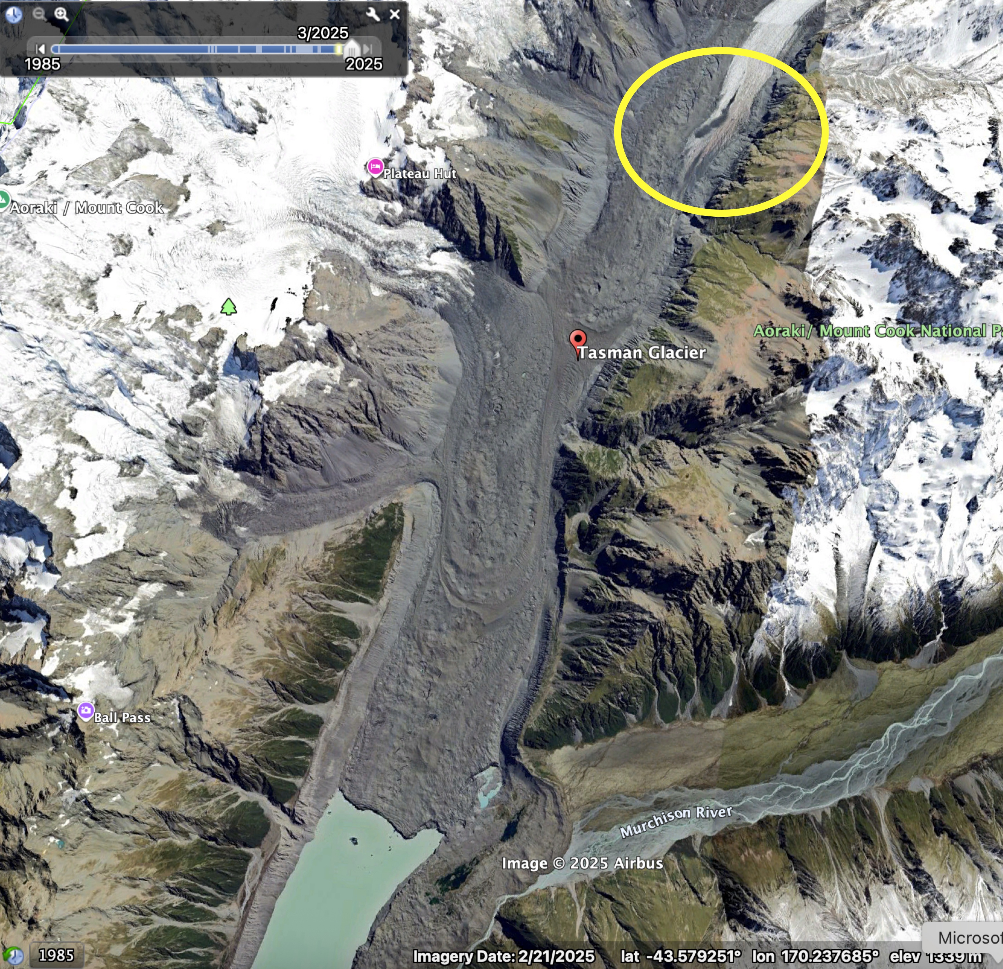
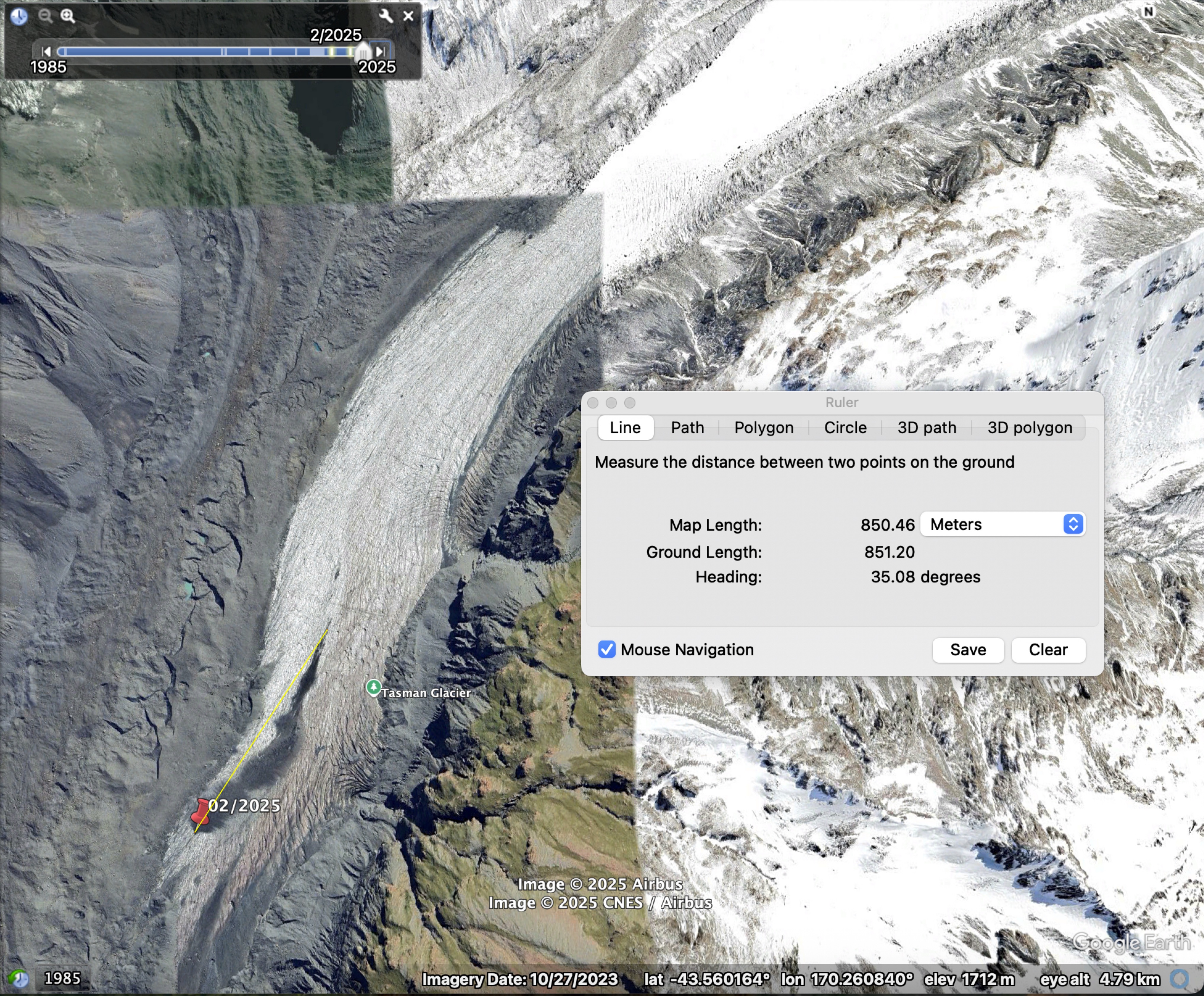
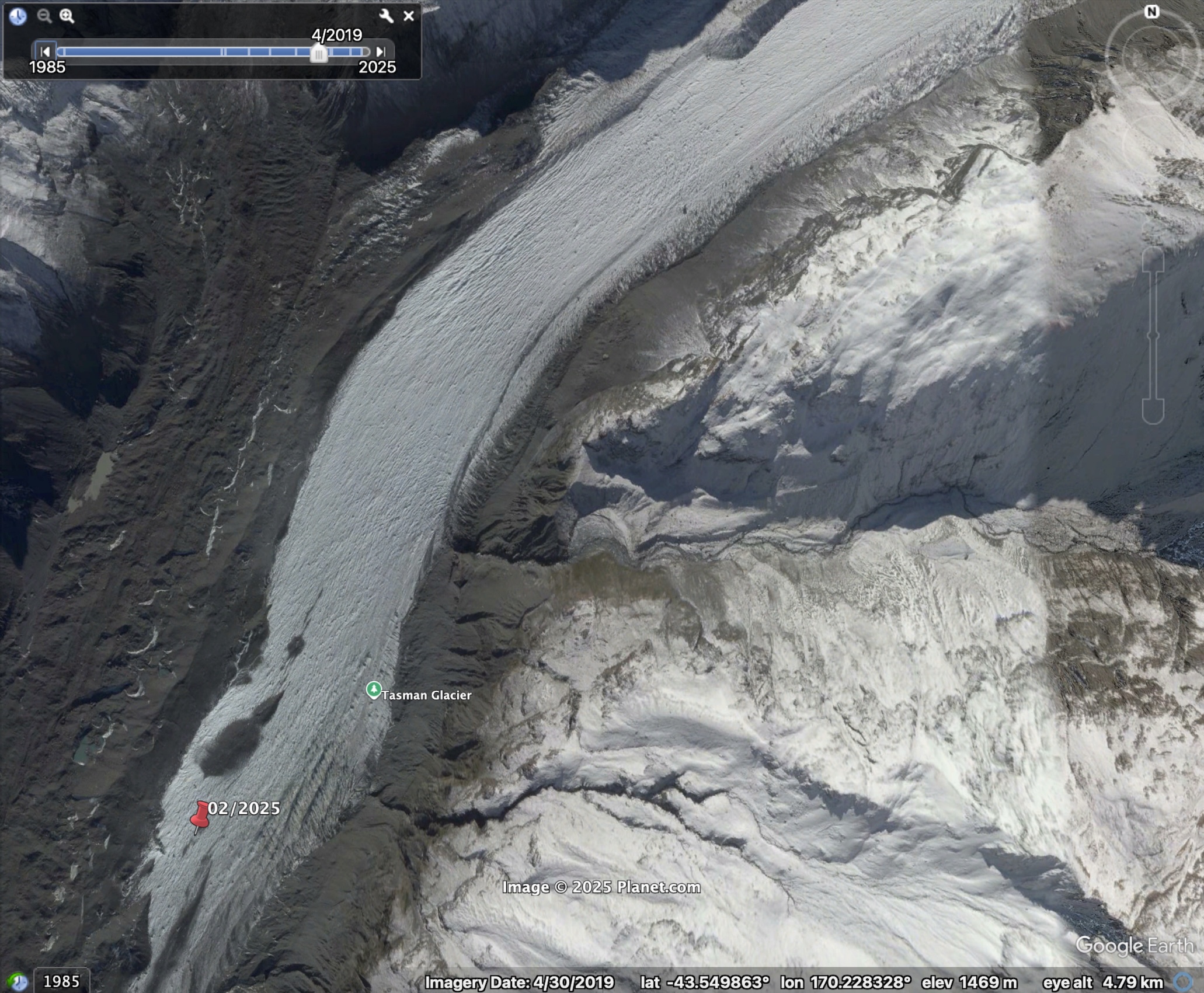
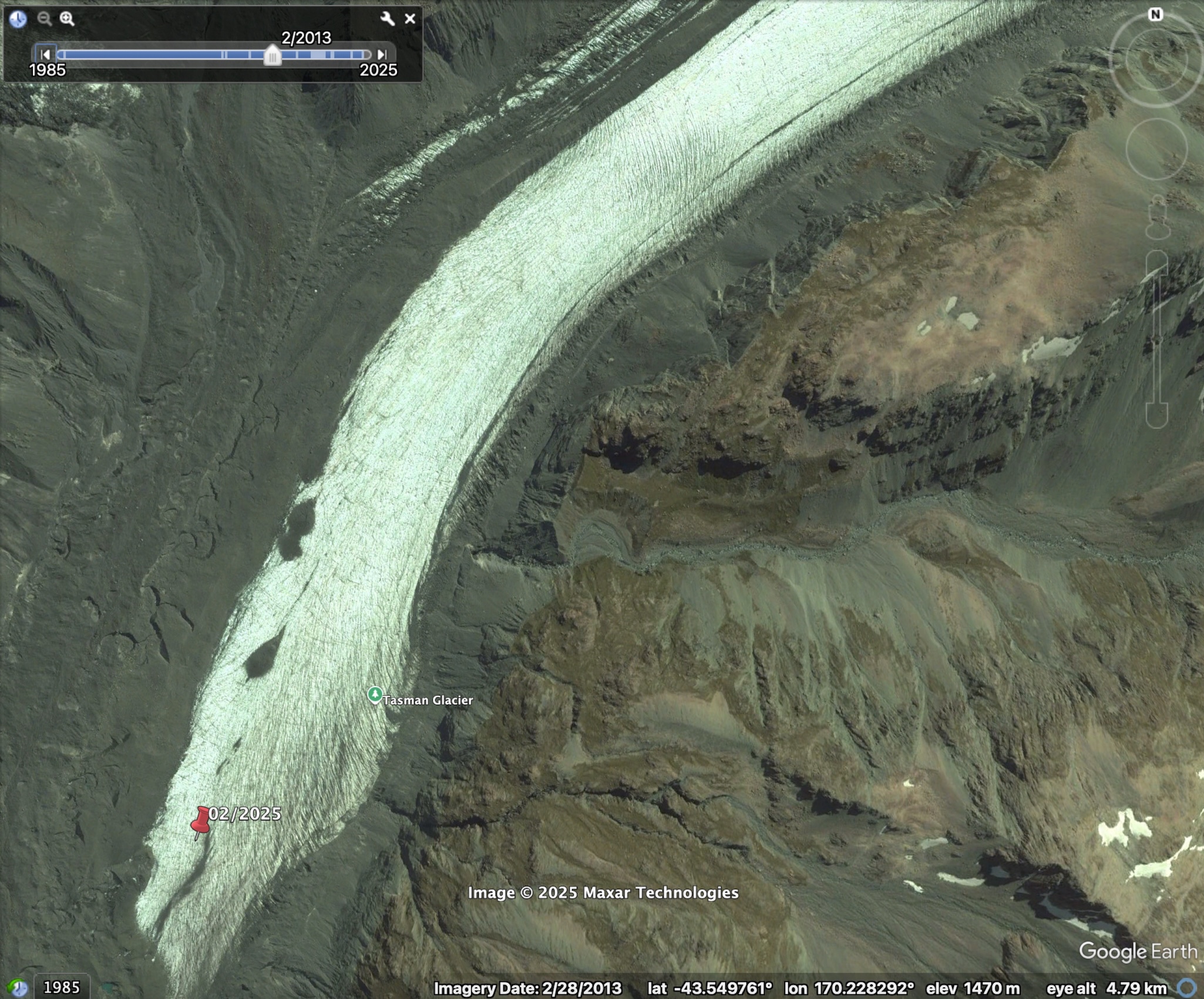
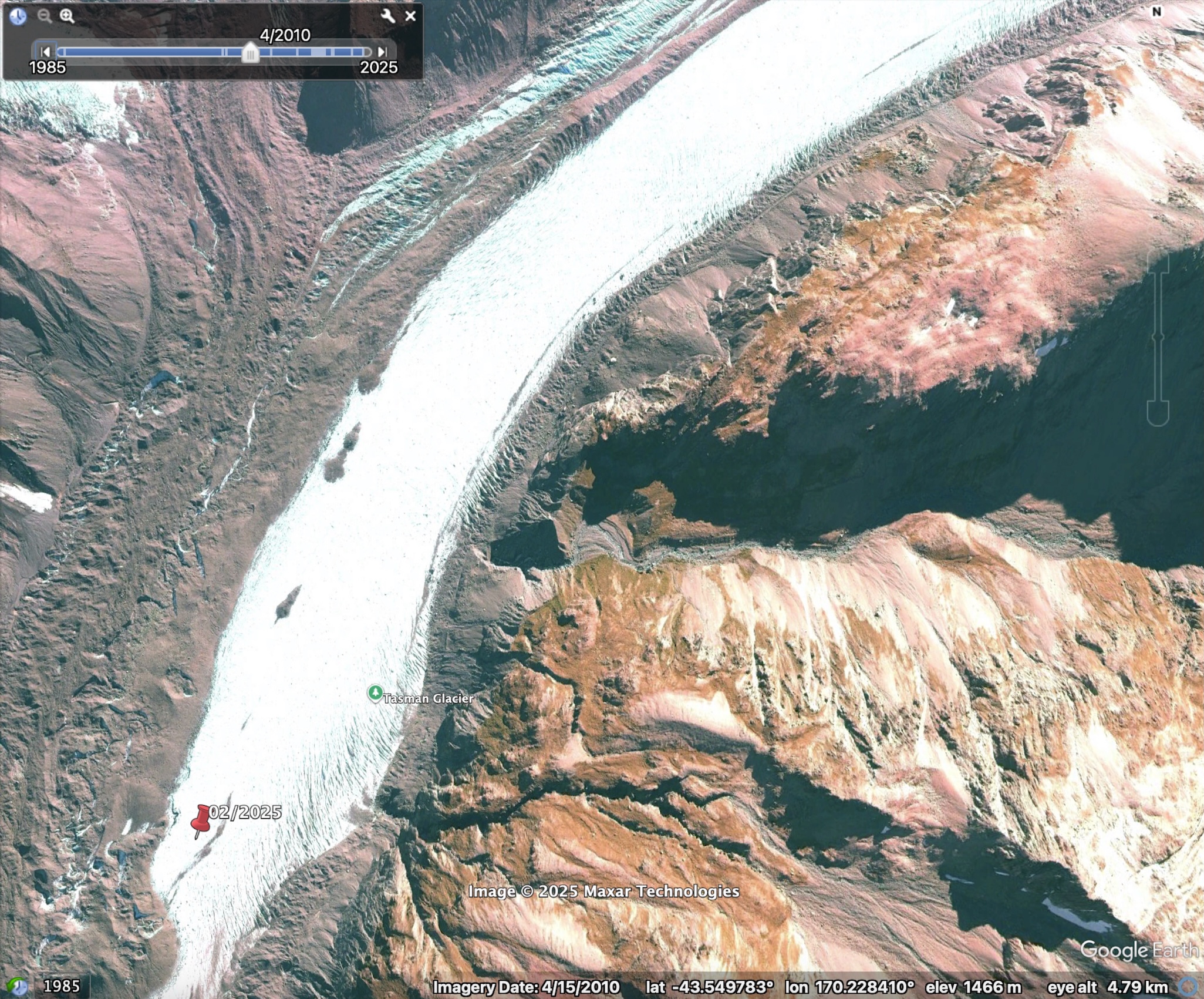
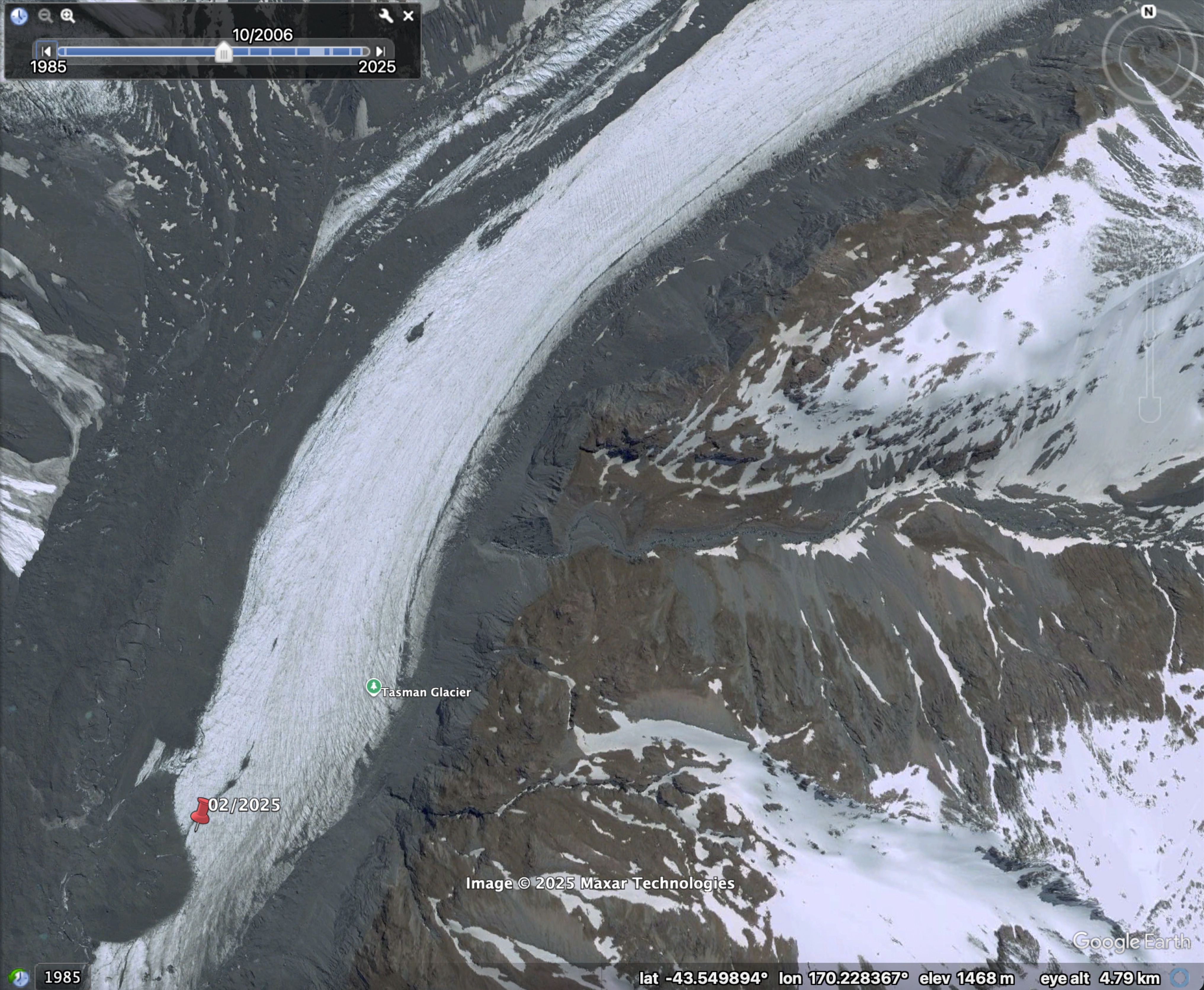
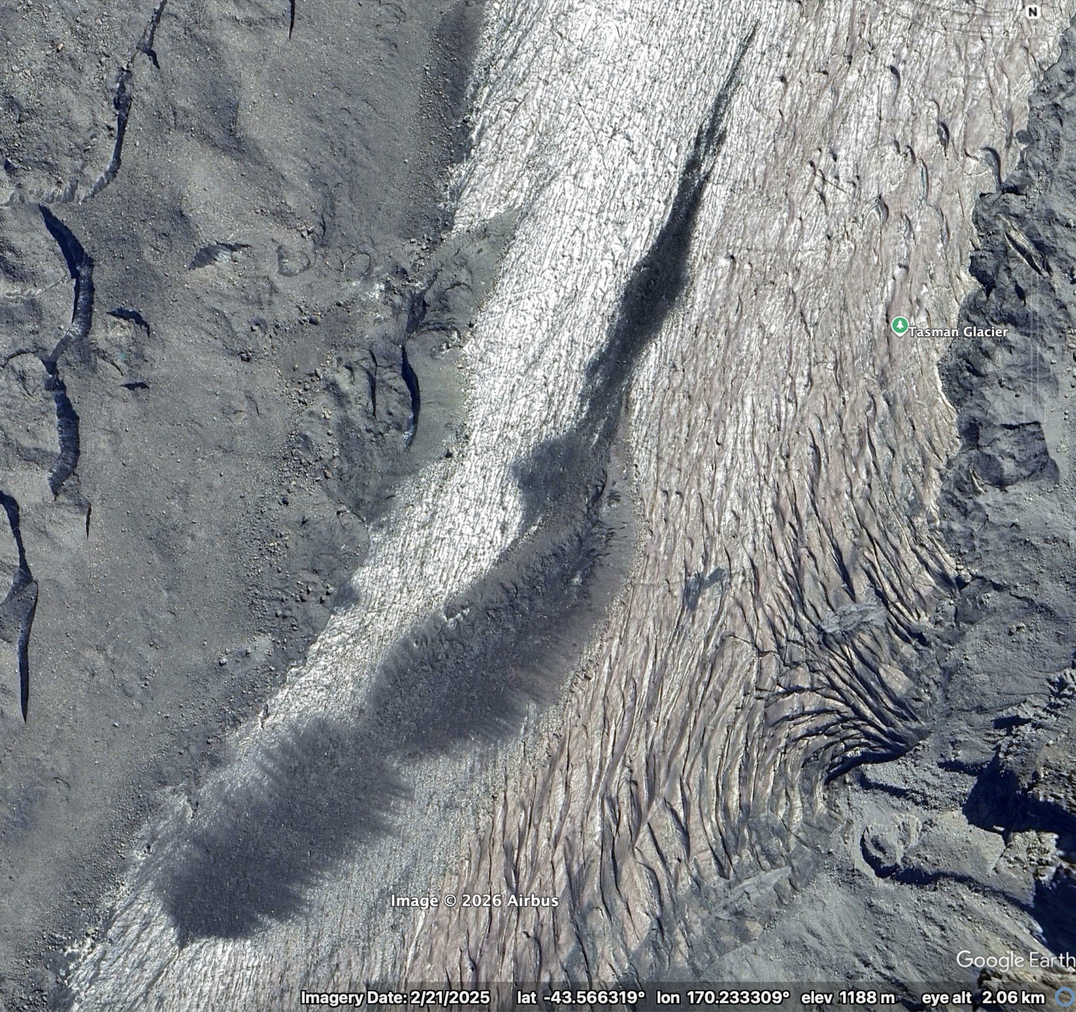
Instead of showing a surface source, the images reveal something more intriguing: the debris “smudge” emerges directly from within the glacier—intact, as a single coherent package. When it first appears in the satellite imagery in 2006, it measures roughly 130 m in length. By 2025, it has expanded to around 900 m. The photos below are snapshots of the deposit in the GE images going back in time from 2025 to 2006, with the 2025 position marked with a red pin.
When I mentioned this in passing to Pascal Sirguey, he immediately suggested it might be a landslide deposit that had been buried by snow in the accumulation zone and transported englacially before melting out in the ablation zone.
I find this fascinating. I’ve never before seen a discrete, intact deposit melt out of glacier ice. While I’ve heard of landslides being incorporated into ice, it hadn’t occurred to me that this process might matter for the development of continuous debris cover. At the other glaciers I’ve worked on, debris typically emerges only after becoming fairly well distributed within the ice. For example, at Satopanth glacier near the ELA, debris is scattered evenly across the surface before gradually merging downglacier into a continuous layer. Perhaps on Satopanth the debris is transported to the ice mainly by avalanches, mixing with snow and becoming dispersed. In contrast, on Haupapa, rockfalls from the near‑vertical valley walls may contain little to no snow, so that deposits are buried with little modification.
The GE imagery of Haupapa suggests the emergence of intact landslide deposits could play an equally important—and perhaps even dominant—role in forming the continuous debris layer. On the true left of the glacier, near the lowest extent of debris‑free ice, the surface is lightly sprinkled with sediment that grades into a continuous layer farther downglacier. Elsewhere, however, the upper boundary of the debris cover is strikingly sharp, which is more consistent with discrete deposits melting out of the ice than with widespread, finely distributed englacial sediment.
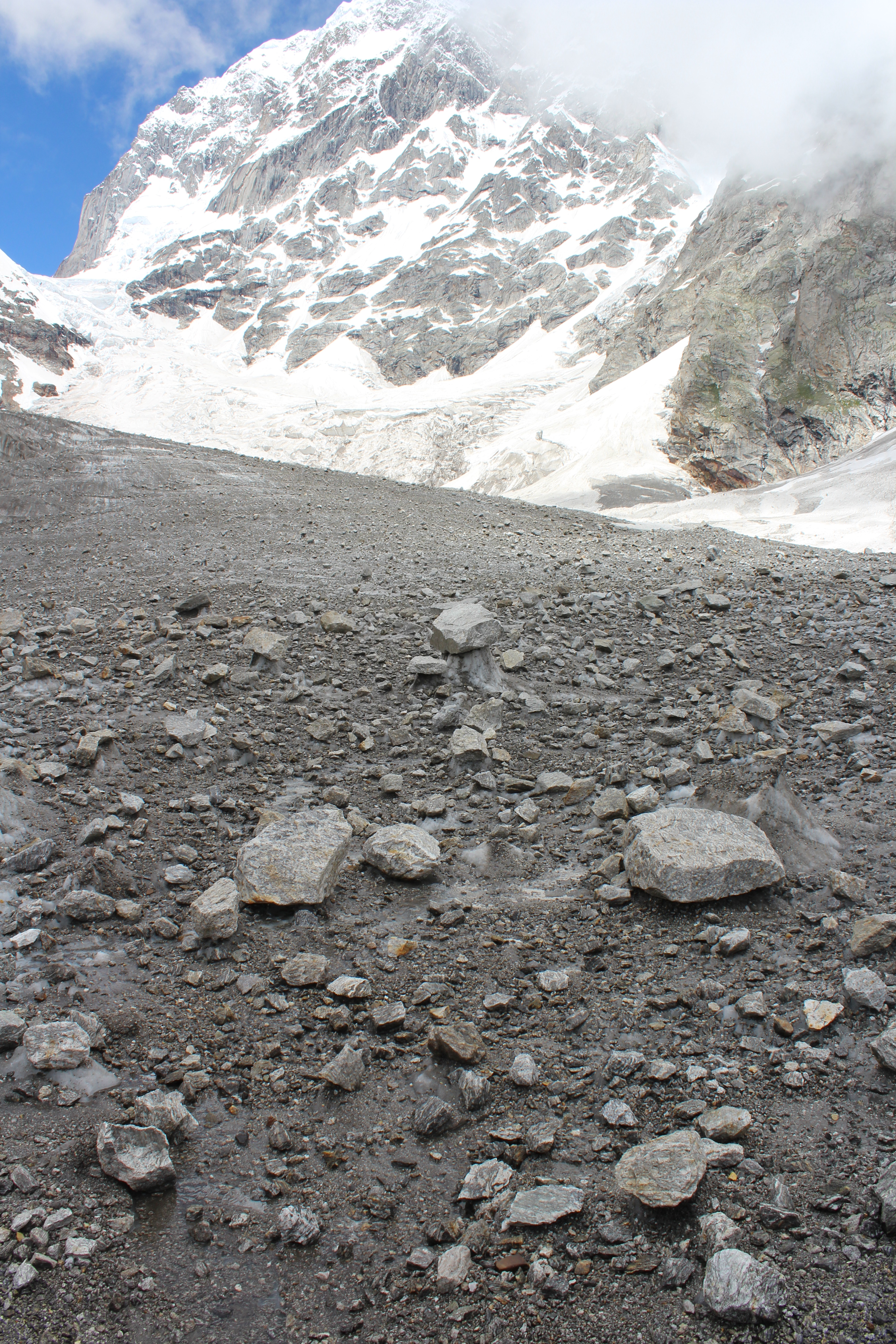
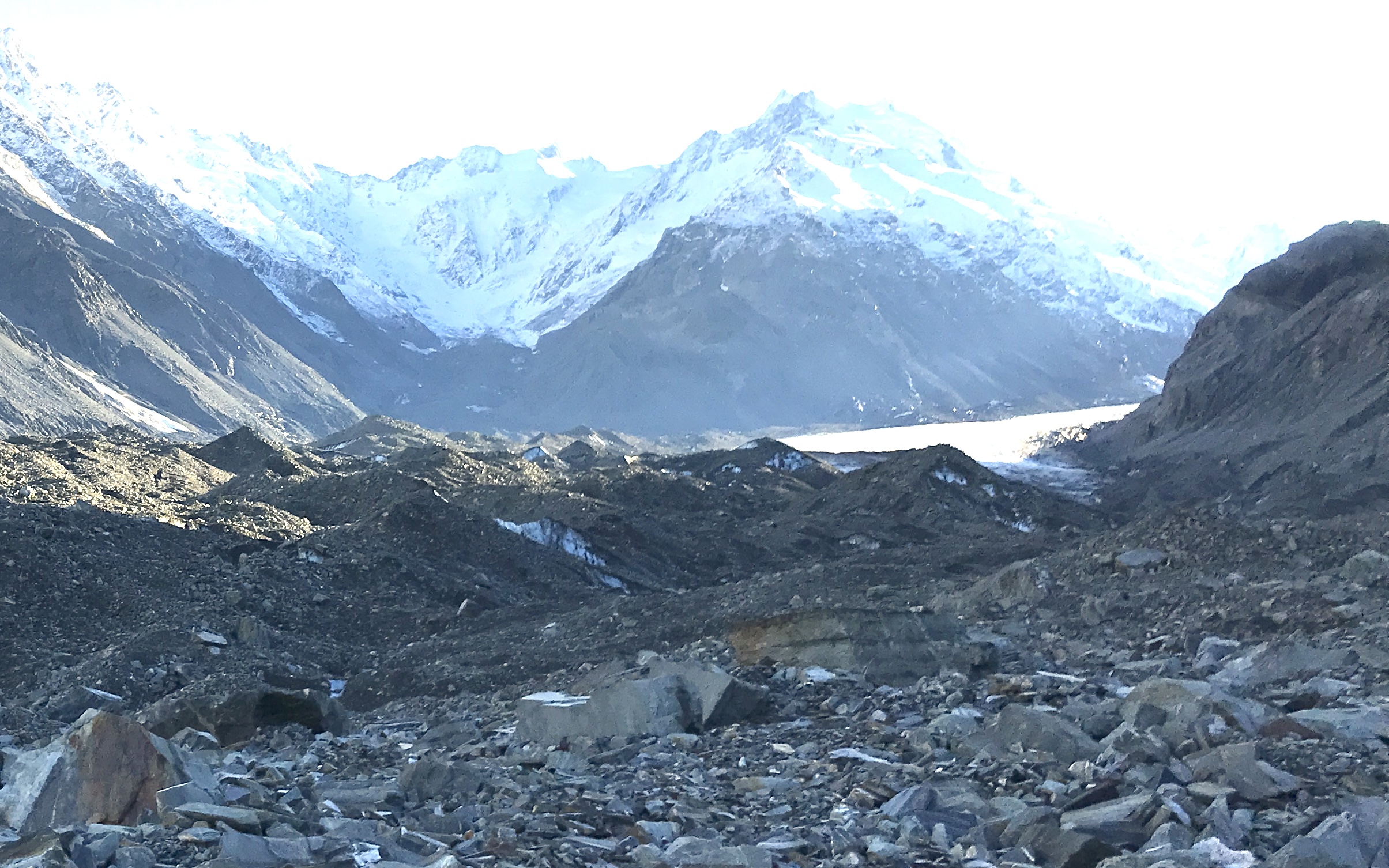
When I camped on Haupapa last year, a few kilometres downstream of this feature, I thought the hummocks had very high‑relief for a position so close to the debris‑free ice – see the photo below. My past experience has been a gradual increase in hummock size as debris cover thickens downglacier. The “smudge” may help explain the difference: an intact landslide deposit emerging from the ice would produce a strong local contrast in melt rates, accelerating differential melting and generating pronounced surface relief relatively quickly.
The “smudge” has some very cool features up-close too. A feathery morphology that might indicate interactions with melt water, or with thrust faults during englacial transport.
Altogether, this small feature on Haupapa hints at a far more dynamic and varied story of debris emergence than I had previously appreciated. The idea that intact landslide deposits can be carried englacially and melt out as coherent blocks adds complexity to my understanding of how debris covers form and evolve. It also underscores how much we still have to learn about the interactions between ice and sediments in these systems—even on a glacier as well studied as Haupapa.
I might have this all completely wrong!! I would love to hear other ideas. Post to the comments and let me know!